Investigating the Past with Edwards-Pitman Environmental
The Edwards-Pitman Environmental archaeology staff has decades of experience in surveying, assessing, and mitigating impacts to precontact and historic archaeological sites throughout the Southeast. We are dedicated to helping you achieve your project goals while being passionate stewards of history. Our employee-owners’ understanding of regulatory requirements and compliance procedures enables us to provide skillful consultation during each phase of project development. We offer assistance and guidance with the archaeological aspects of projects from their earliest stages of planning.
We have extensive experience working with a variety of federal, state, and private agencies such as the United States Fish and Wildlife Service (USFW), United States Forest Service (USFS), National Park Service (NPS), and the United States Army Corps of Engineers (USACE), as well as state Departments of Transportation in Georgia, Tennessee, and South Carolina. We have experience producing Section 106 documentation in a variety of contexts.
Archaeological Services
Phase I Survey, Phase II Testing, and Phase III Data Recovery
Edwards-Pitman Environmental’s archaeology group has decades of archaeological experience in Georgia and a record of successful completion of all phases of archaeological investigation of varying levels of complexity. We have forged strong relationships with our clients, both public and private, in the completion of large-scale linear projects for transportation and energy infrastructure, as well as large-tract surveys for both public and private developments. Our team of archaeological professionals are skilled mapmakers and produce high-quality report graphics in ArcGIS to display the results of our projects.
Phase I Archaeological Survey
Phase I archaeological surveys are one of the most requested services from our clients. Consequently, our experience with large-scale Phase I surveys includes work in every part of Georgia, including coastal and maritime environments, heavily urbanized areas, and remote rural locales. Our archaeologists have identified precontact era sites, historic period farming establishments, and battlefield sites across Georgia and evaluated these sites for eligibility to the National Register of Historic Places (NRHP).
Phase II Archaeological Testing
Our archaeology group is comprised of archaeologists with a wide range of research interests, and this makes our team specially suited for Phase II testing excavations. This phase of work is intended to determine the spatial extent and integrity of the site and, insofar as possible, when and by whom. Our precontact era specialists have completed investigations at sites from every part of Georgia and have the capacity to field crews for the investigations of multiple sites simultaneously. Our historic period specialists have experience with testing excavations in Georgia’s historic neighborhoods and districts.
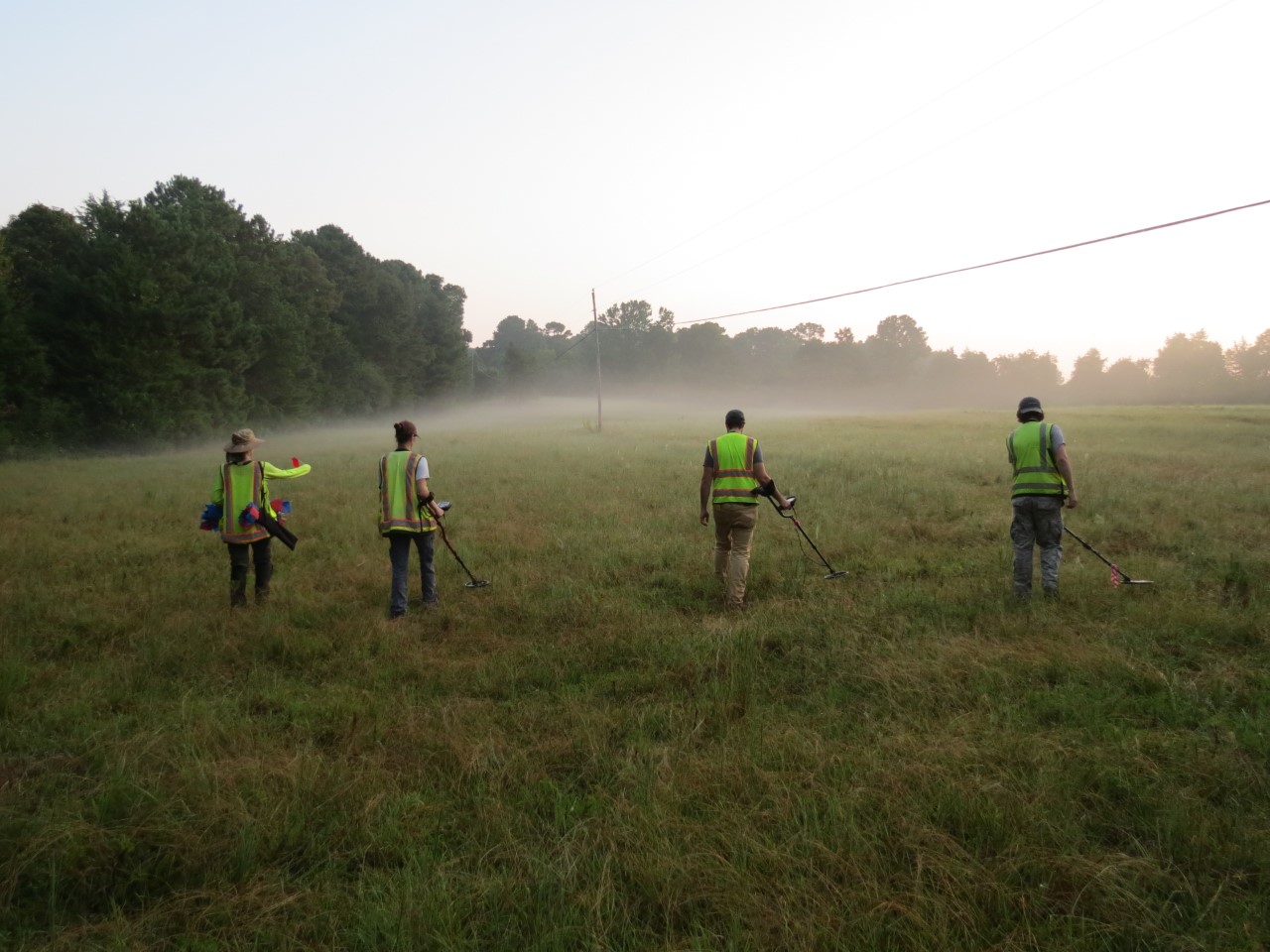
In all cases, our employee-owners employ state-of-the-art technology in ground penetrating radar (GPR), metal detecting, and other non-invasive scanning technologies to increase the effectiveness and efficiency of our research endeavors. Our archaeologists are particularly experienced in battlefield archaeology and have experience on Civil War battlefields related to the Atlanta Campaign and the March to the Sea.
Phase III Archaeological Data Recovery
Data recovery excavations are some of the largest and most complex projects undertaken by the Edwards-Pitman archaeology team. Data recovery investigations occur when potentially significant resources will be impacted by development. Large-scale excavations are completed to fully document the cultural and chronological sequence of the site, the horizontal and vertical extent of cultural deposits, and their integrity in order to answer research questions and meet specific research objectives.
Geophysical Archaeology
We have expertise in utilizing advanced geophysical methods during investigations for our clients. GPR, for example, utilizes radar pulses to locate and estimate the depth of various subterranean features. GPR can be used in planning site excavations and identifying archaeological features in urban settings where pavement impedes test excavations. It can also be used as a non-invasive means of delineating sensitive resources, such as searching for unmarked graves in historic cemeteries. Metal detection is another geophysical method that we apply to locate, excavate, and record the precise provenience of metallic artifacts, especially for battlefield archaeology and historic site delineation.
Bioarchaeology
When necessary, we provide expertise on the identification, excavation, analysis, and reinterment of human remains. This service complements cemetery delineations when proposed projects cannot avoid impacts to a cemetery. This work is done under individual state laws regarding cemetery/burial removal. This expertise also lends itself to the identification of faunal remains, which can often mimic human remains to the untrained eye.
Underwater Archaeology
We have trained underwater archaeologists on staff who can identify, analyze, and conduct archaeological surveys of maritime or submerged cultural resources through both desktop surveys and diver-led investigations. Our scientific divers can provide expertise on projects in various bodies of water, including lakes and riverine environments.
Laboratory Services
We have experience curating project materials from Phase I, Phase II, and Phase III projects across the Southeast for a variety of agencies. Our archaeology laboratory is equipped with 860 square feet of lab space, including two large sinks with four washing stations, three large drying racks with 96 partitioned drying locations, and large shelving for artifact storage to process and prepare artifacts for curation. For analyzing artifacts, we also have a stereoscopic microscope in the lab to assist in artifact identification and to perform use-wear analysis on lithic tool assemblages. We have the capacity to take professional quality artifact photography and editing on-site. We can also perform artifact identification, cataloging, and curation prep and submission in accordance with certified curatorial repositories that meet federal standards (36 CFR 79).